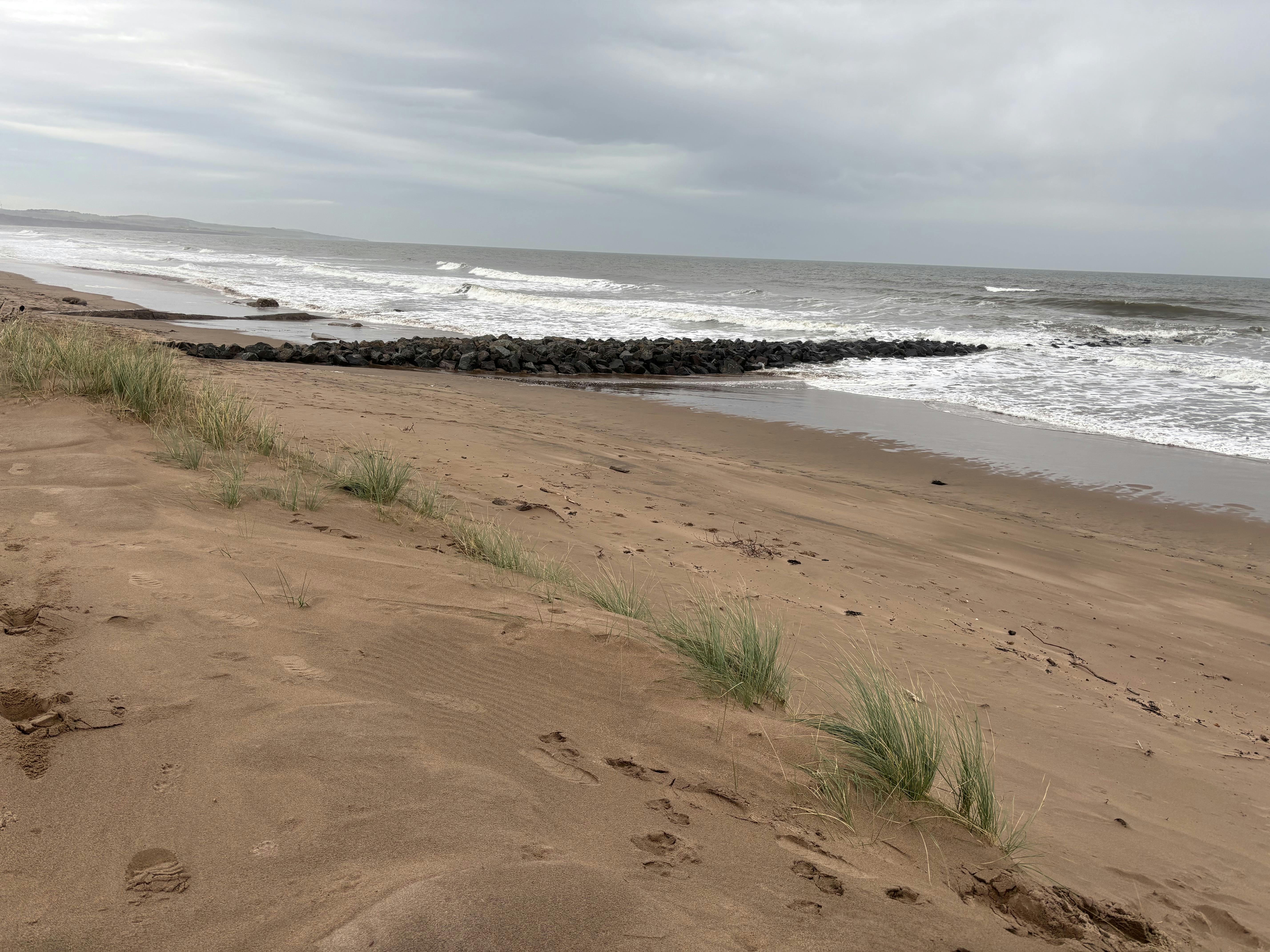
Montrose Coastal Erosion Project

Share Montrose Coastal Erosion Project on Facebook Share Montrose Coastal Erosion Project on Twitter Share Montrose Coastal Erosion Project on Linkedin Email Montrose Coastal Erosion Project link
Montrose Coastal Erosion


Sign up to follow this project and get regular updates as work progresses.

Background

The dunes along the Montrose Golf Links are a natural coastal flood barrier to the town.

In recent years, however, the dunes have eroded significantly. The rate of future erosion is now predicted to be higher than previously anticipated.

With a predicted rise in sea levels and increasingly intensive storms, future erosion could open up flood corridors through gaps in the dunes. This could result in flooding to low-lying areas on and around the golf course.

Monitoring erosion

We have been working with technical experts to:

  • monitor erosion rates
  • develop long and short-term erosion management strategies

Dynamic Coast and the University of Glasgow have measured changes in the dunes, and used modelling to predict future shoreline changes.

They will continue to monitor and update their predictions for the rate of future erosion.

Long term strategy

Phase 1 – Dune restoration and beach nourishment

This would be done by importing sediment to reform the dunes and restore beach levels. This will retain defence levels and reduce the risk of further erosion.

Phase 2 – Beach recharge

Some imported sediment will be lost, so the long-term plan will be to “top up” the material. Work will continue until the beach has re-nourished and gives some natural protection from the forces causing erosion.

Potential sites from where sand (dredged material) can be sourced are currently being explored and the environmental risks assessed using Environmental Options Appraisals. The feasibility of transporting material is also being investigated.

Managing erosion in the short-term

Sourcing, transporting and placing the sediment will take time. As will obtaining funding for the long-term proposals.

In the meantime, work to prevent further erosion in the most vulnerable locations of the dunes in the short-term, is being progressed.

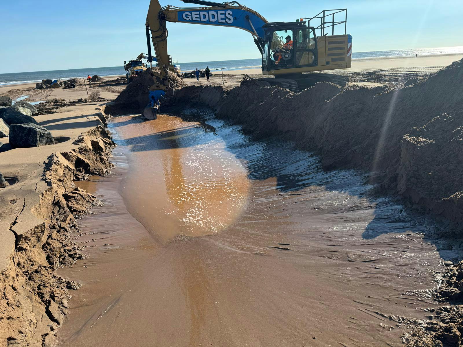
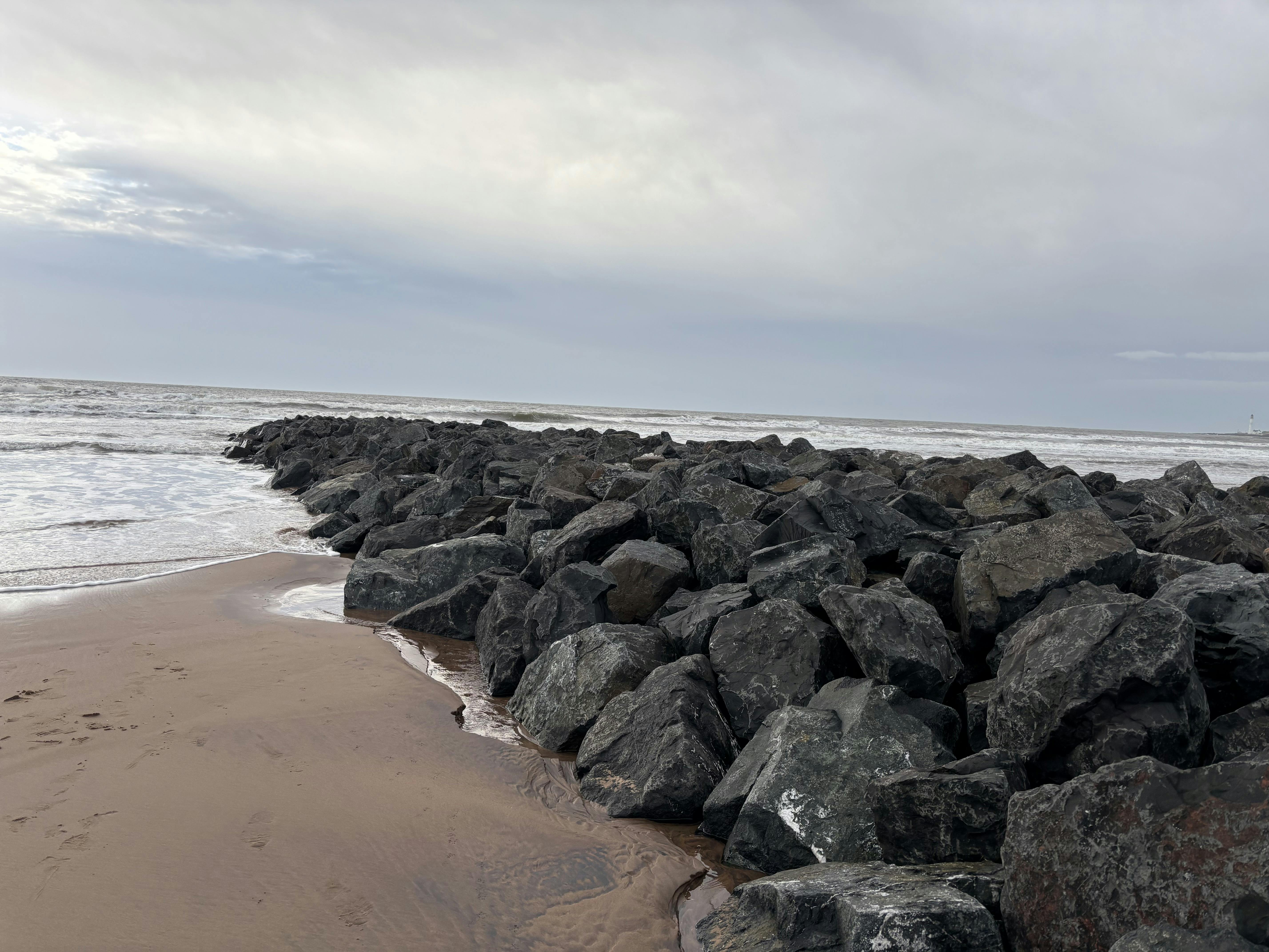
This includes the construction of two rock groynes. Rock groynes are rock armour structures that reduce the movement of sand on the beach, encouraging beach nourishment.

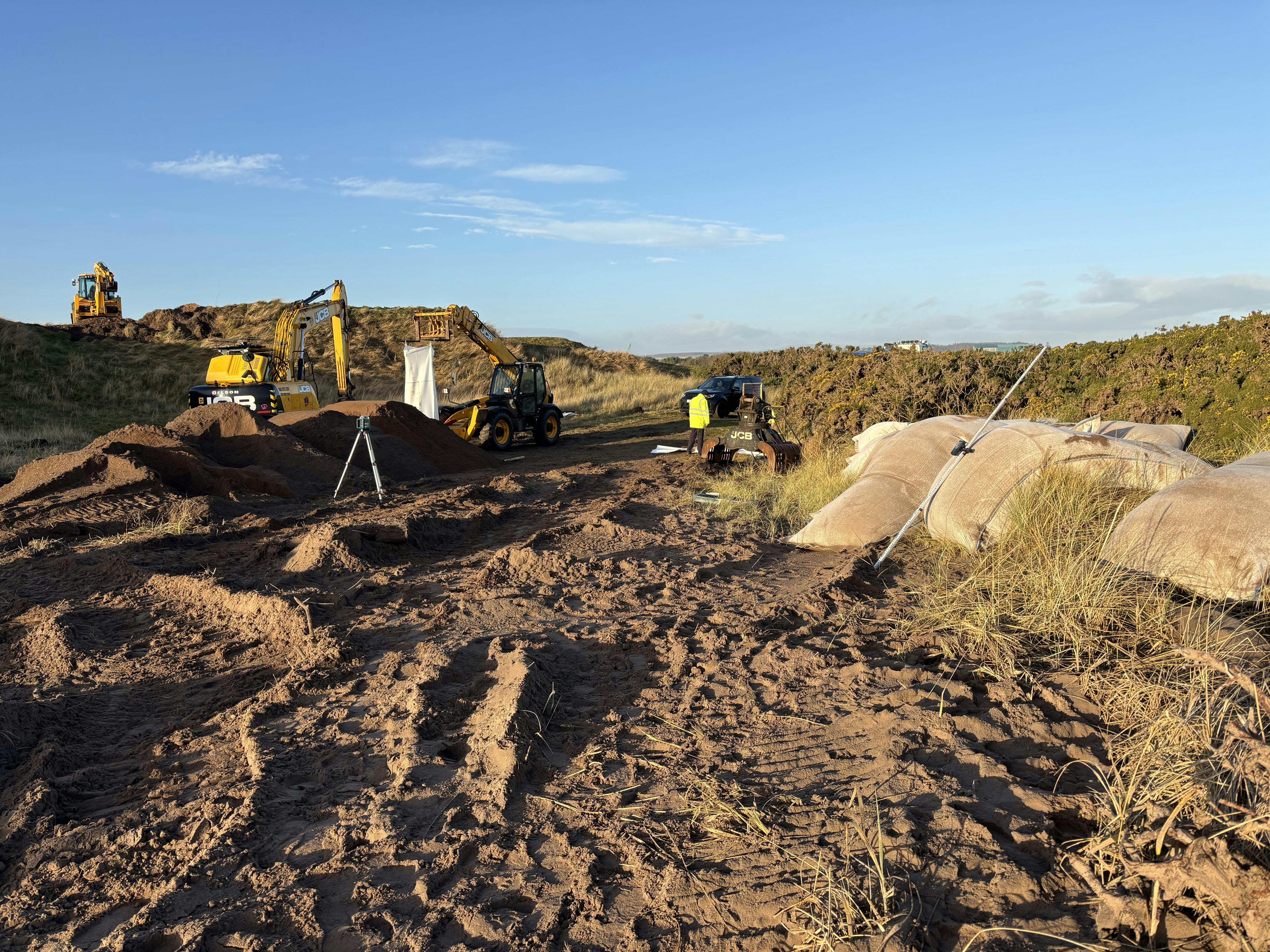
Additional short-term works to provide direct dune defences, with the installation of specially engineered large sand bags, are now complete .

Why dune restoration?

The shoreline along the links is subject to high wave energy. This is likely to undermine any fixed hard engineered solutions. Piled solutions would be extremely costly.

Installations such as gabion baskets have a limited life due to corrosion. They also need continual maintenance.

Restoring the dunes and beach with imported sand will enhance the beach volumes. and over time distribute sand across the bay. Raising the level of the beach will increase the dissipative properties of the intertidal area, acting to absorb more wave energy. Building the beach will protect the dunes.

Funding

Angus Council have secured £440,000 from the Scottish Government's Coastal Change Adaption Fund. This will fund the short-term erosion management measures and the development of the long-term erosion management strategy.

A business case is being developed to support an application for further funding of the long-term erosion management strategy.

Key project partners

  • Montrose Golf Links
  • Montrose Port Authority
  • Marine Directorate
  • NatureScot
  • Dynamic Coast
  • SEPA

Environmental Impact Assessment (EIA)

EIAs help planning authorities assess the environmental impact of proposals. EIAs can be costly and time consuming due to the detail required for the surveys and assessment.

The EIA screening process has found that this project does not require an EIA. It will, however, need full planning permission and a relevant marine licence.


  • Montrose Dunes consultation attracts around 100 local people

    Share Montrose Dunes consultation attracts around 100 local people on Facebook Share Montrose Dunes consultation attracts around 100 local people on Twitter Share Montrose Dunes consultation attracts around 100 local people on Linkedin Email Montrose Dunes consultation attracts around 100 local people link

    A public consultation event about the ongoing response to coastal erosion at Montrose was held at the town’s sports centre yesterday.

    The event attracted around 100 people from the local community who were able to view information about the ongoing Montrose Coastal Erosion Project and discuss matters with the project consultant.

    The dunes along the Montrose Golf Links are a natural coastal flood barrier to the town. In recent years, however, the dunes have eroded significantly, and the rate of future erosion is now predicted to be higher than previously anticipated.

    With a predicted rise in sea levels and increasingly intensive storms, future erosion could open up flood corridors through gaps in the dunes and this could result in flooding to low-lying areas on and around the golf course.

    Angus Council and its local and national partners has been working with technical experts to monitor erosion rates and develop long and short-term erosion management strategies.

    Dynamic Coast and the University of Glasgow have measured changes in the dunes, and used modelling to predict future shoreline changes. They will continue to monitor and update their predictions for the rate of future erosion.

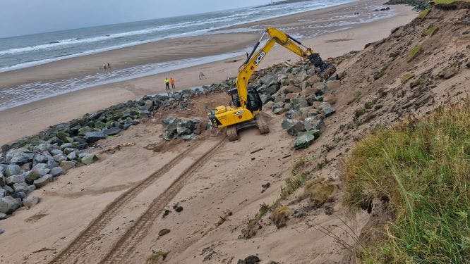
    As part of managing erosion in the short-term, work to prevent further erosion in the most vulnerable locations of the dunes has resulted in engineered sandbags being put in place at the dunes’ low points and rock armour re-profiling being carried out at the 2nd Tee of Montrose Golf Links.

    Short-term management will also include the construction of two rock groynes - rock armour structures that reduce the movement of sand on the beach, encouraging beach nourishment.

    The design and construction of the groynes were the focal point of Wednesday’s consultation and those attending were encouraged to follow-up with any further questions they might have after the event.

    A range of topics and questions were raised at the time including - groynes’ design and location; funding; beach accessibility; the impact of operations and construction; and the wider replenishment project.

    Many of those who attended expressed a desire for work to progress as quickly as possible and an interest in the scheme when it extends into longer term measures.

    The rock groynes require a Marine Licence, and consultation forms an important part of the approval process.

    The contents provided at the Montrose Beach Groynes Public Consultation is available via the project page on Engage Angus.

    You can still provide feedback on the proposed groynes work before submission of the marine licence application. To provide feedback please email katie.britton@aecom.com, or by post to AECOM, Tanfield, Edinburgh, EH3 5DA before 19 April 2025.

  • Montrose Dunes Short-term Erosion Management

    Share Montrose Dunes Short-term Erosion Management on Facebook Share Montrose Dunes Short-term Erosion Management on Twitter Share Montrose Dunes Short-term Erosion Management on Linkedin Email Montrose Dunes Short-term Erosion Management link

    Work on the Montrose Coastal Erosion Project has continued, with engineered sandbags now in place at the dunes’ low points.

    These, “larger than your average” sandbags are robust and filled with quarried sand. They’ve been positioned within the low points in the dunes at the “pipey” and at points to its north and south. While only intended to be a temporary measure, they will provide short-term flood protection and prevent further erosion at the more vulnerable low points.

    This work follows on from the rock armour re-profiling at the 2nd Tee of the Montrose Golf Links in October ’24, a programme of work that was funded by the Montrose Common Good Fund and Montrose Golf Links.

    Design work for the construction of two rock groynes is now complete and progressing through the consenting process towards construction.

    The purpose of the proposed rock groynes is to interrupt the movement of sand along the beach, helping to retain material and slow down the erosion at the most vulnerable locations. Options for the long-term dune restoration and beach nourishment are still being investigated as part of the wider project.

    A public consultation about the design and construction of the rock groynes is scheduled to take place on Wednesday 5 March, from 3-7pm at the GP room at Montrose Sports Centre.

    The project designer will be available to answer any questions and receive comments on the design, environmental impact considerations and the consenting process. The rock groynes require a Marine Licence, and consultation forms an important part of the approval process.

    The Business Case to support a funding application for the Montrose Coastal Erosion Project is nearing completion. As part of this, a new Digital Elevation Model has been developed based on the latest topographical data. This is being used to determine the changes in the dunes and allow more accurate predictions of the rates of erosion to be established.

  • October 2024 update

    Share October 2024 update on Facebook Share October 2024 update on Twitter Share October 2024 update on Linkedin Email October 2024 update link

    Ongoing work at Montrose dunes

    Immediate work, as part of the wider Montrose Coastal Erosion Project, continues with the reprofiling of the existing rock armour at the 2nd tee of the Montrose Golf Links carried out in October.

    The rock armour was being overtopped by waves and had been sinking below the beach level, which meant it was no longer providing the erosion protection it was intended for. And so, the rock armour was moved closer to the dune face and reprofiled in a programme of work that was funded by the Montrose Common Good Fund and the golf club.

    Plans to construct two rock groynes on Montrose beach to encourage beach nourishment will now take place in 2025 and not before the end of this year as originally intended. This is due to design requirements, consenting processes, and restrictions on working hours and associated construction costs during winter.

    Shorter-term options have been investigated - focussing on the most vulnerable points in the dunes, at the ‘pipey’ and directly north and south of the ‘pipey’. We will now infill the low points in these locations with large specially engineered sandbags. This work, which will be carried out in November, will help prevent further erosion at these locations and support the dunes until the long-term proposals can be put in place.

    With regards to long-term proposals, the Business Case to support a funding application for the project is well underway and should be completed in early 2025. As part of this, a new Digital Elevation Model has been developed based on the latest topographical data. This is being used to determine the changes in the dunes and allow more accurate predictions of the rates of erosion to be established.