Montrose Coastal Erosion Project

Sign up to follow this project and get regular updates as work progresses.
Background
The dunes along the Montrose Golf Links are a natural coastal flood barrier to the town.
In recent years, however, the dunes have eroded significantly. The rate of future erosion is now predicted to be higher than previously anticipated.
With a predicted rise in sea levels and increasingly intensive storms, future erosion could open up flood corridors through gaps in the dunes. This could result in flooding to low-lying areas on and around the golf course.
Monitoring erosion
We have been working with technical experts to:
- monitor erosion rates
- develop long and short-term erosion management strategies
Dynamic Coast and the University of Glasgow have measured changes in the dunes, and used modelling to predict future shoreline changes.
Dynamic Coast and the University of Glasgow were commissioned by Angus Council in September 2024 to undertake an update on the coastal erosion effecting Montrose beach and dunes, and consider the implications on flood and erosion risk management with the impact of climate change. Survey of the dunes were undertaken in March and September 2024. The report was completed in April 2025 and concluded that erosion continues to affect much of the dunes and many parts of the beach within Montrose Bay, with some of the fastest known rates of change on record measured during winter 2023/24.
They will continue to monitor and update their predictions for the rate of future erosion.
Long term strategy
Phase 1 – Dune restoration and beach nourishment
This would be done by importing sediment to reform the dunes and restore beach levels. This will retain defence levels and reduce the risk of further erosion.
Phase 2 – Beach recharge
Some imported sediment will be lost, so the long-term plan will be to “top up” the material. Work will continue until the beach has re-nourished and gives some natural protection from the forces causing erosion.
Potential sites from where sand (dredged material) can be sourced are currently being explored and the environmental risks assessed using Environmental Options Appraisals. The feasibility of transporting material is also being investigated.
Pedestrian access to Montrose beach in the longer-term will be included in the dune restoration works to ensure formal access points to discourage people from walking over the dunes which can damage the Marram Grass and increase exposure to erosion.
Managing erosion in the short-term
Sourcing, transporting and placing the sediment will take time. As will obtaining funding for the long-term proposals.
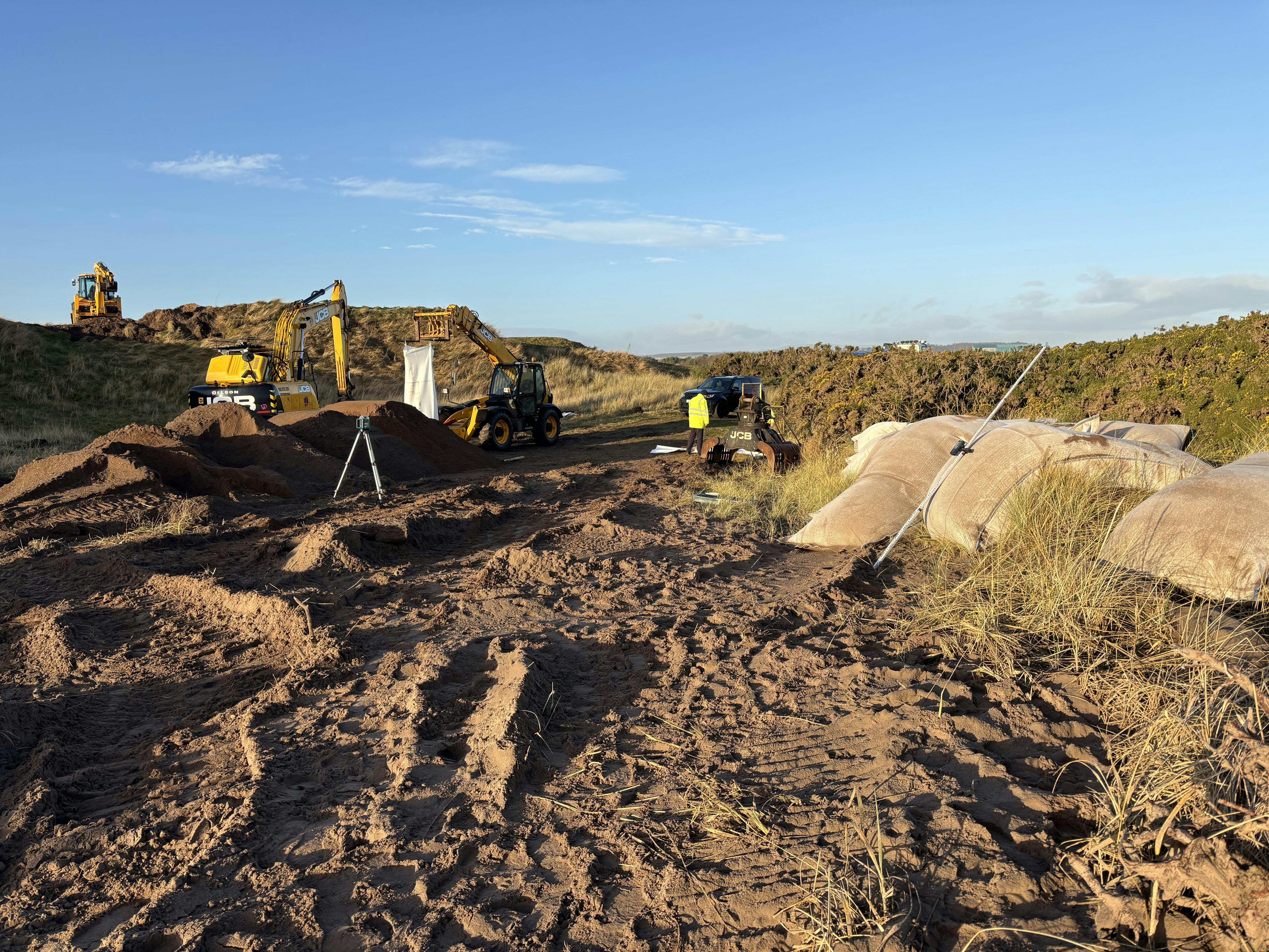
In the meantime, work to prevent further erosion in the most vulnerable locations of the dunes in the short-term, is being progressed. In December 2024, specially engineered sand bags were installed at the lowest points in the dunes to help prevent further erosion and reduce flood risk.
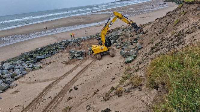
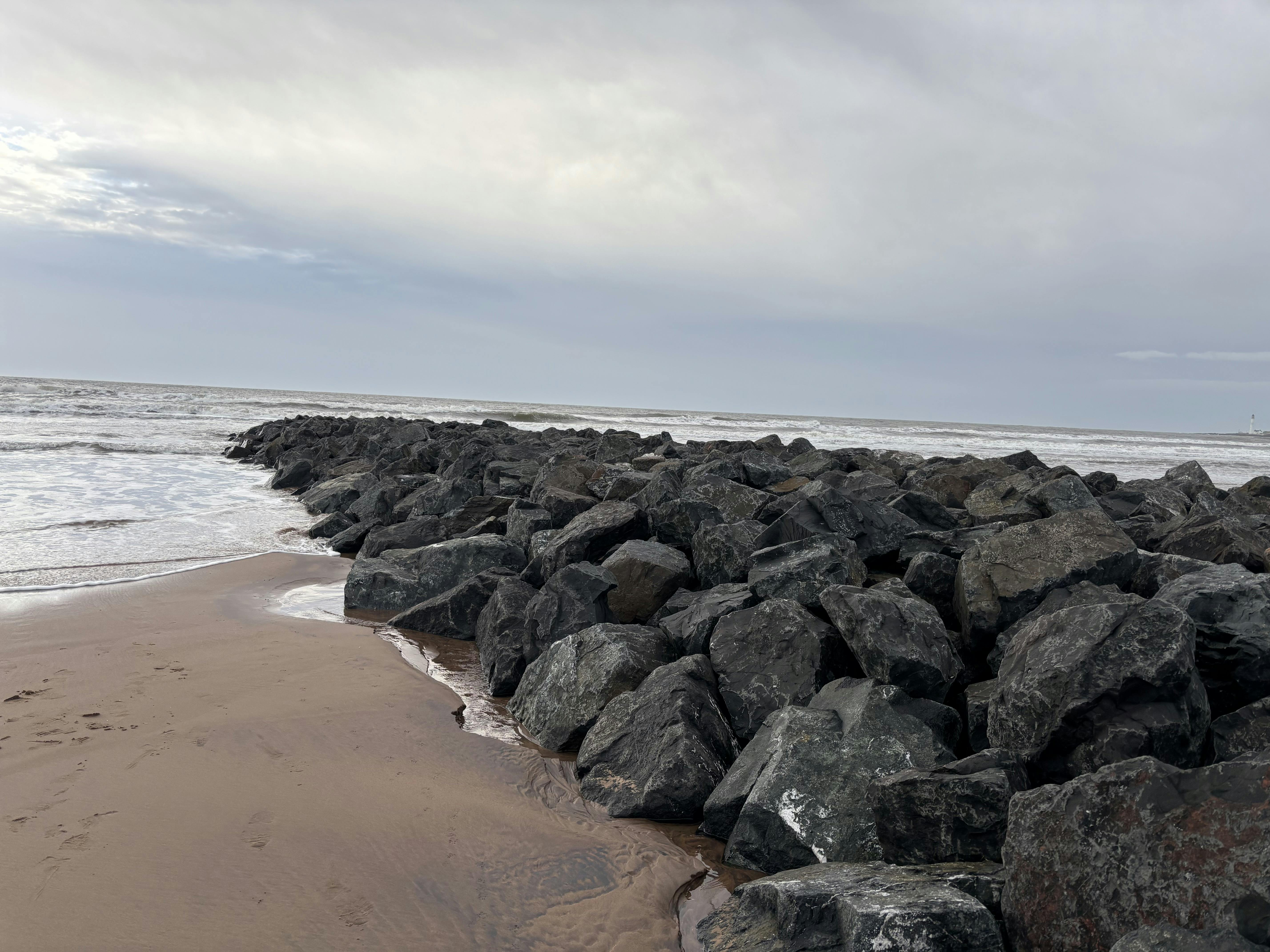
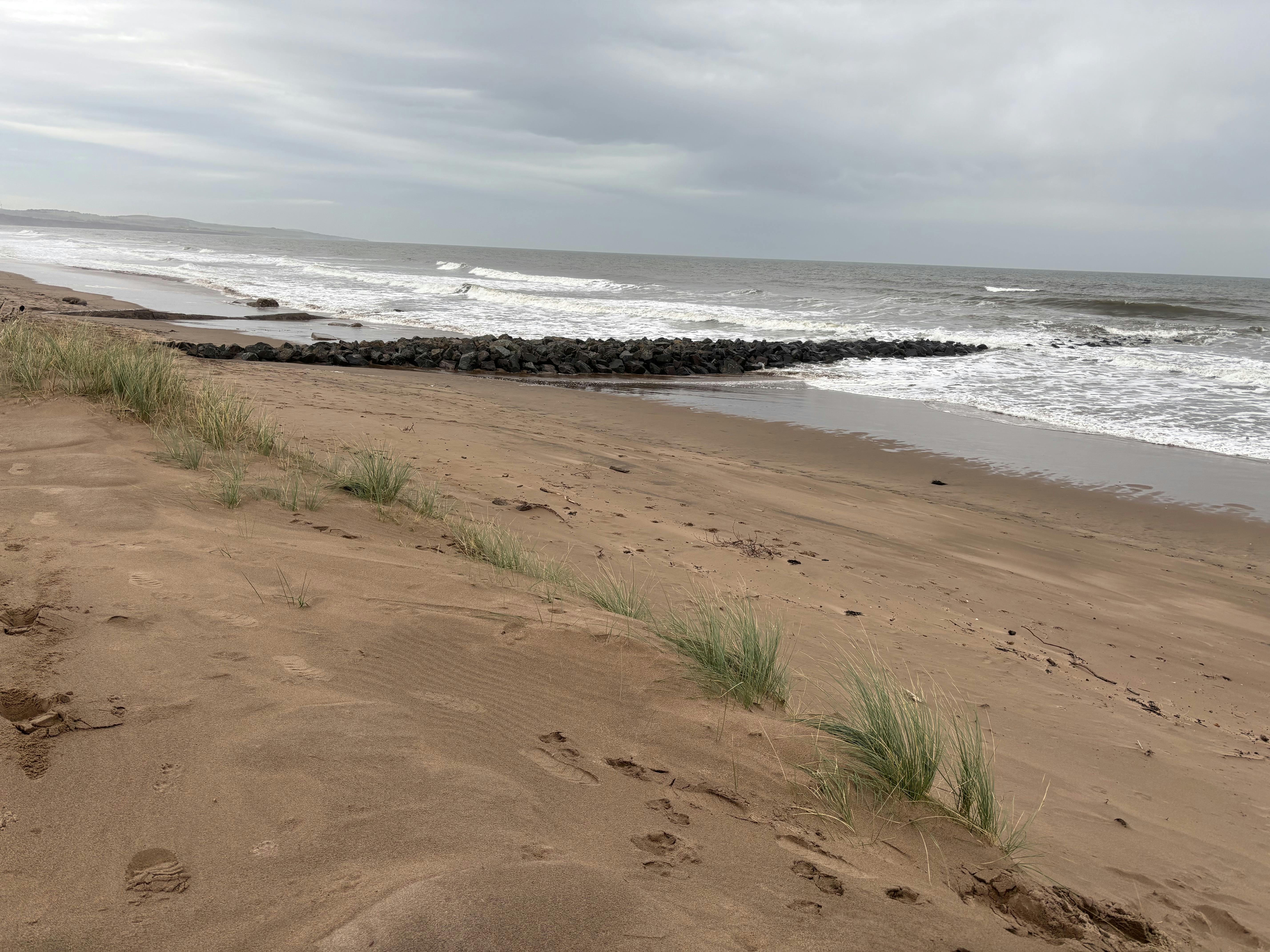
The proposal to construct two rock groynes on the beach at Montrose received all consents and approvals in September 2025. Rock groynes are rock armour structures that reduce the movement of sand on the beach, encouraging beach nourishment. Construction of the first rock groyne, adjacent to the 'pipey', begins in October 2025.
Constructing one groyne initially allows its performance to be monitored in isolation, particularly how quickly sediment is collected without interference. Construction during the wetter, darker months carries additional risks and limitations, monitoring would allow for any future groyne construction to be undertaken during better conditions.
Why dune restoration?
The shoreline along the links is subject to high wave energy. This is likely to undermine any fixed hard engineered solutions. Piled solutions would be extremely costly.
Installations such as gabion baskets have a limited life due to corrosion. They also need continual maintenance.
Restoring the dunes and beach with imported sand will enhance the beach volumes. and over time distribute sand across the bay. Raising the level of the beach will increase the dissipative properties of the intertidal area, acting to absorb more wave energy. Building the beach will protect the dunes.
Funding
Angus Council have secured £440,000 from the Scottish Government's Coastal Change Adaption Fund. This will fund the short-term erosion management measures and the development of the long-term erosion management strategy.
A business case is being developed to support an application for further funding of the long-term erosion management strategy.
Key project partners
- Montrose Golf Links
- Montrose Port Authority
- Marine Directorate
- NatureScot
- Dynamic Coast
- SEPA
Environmental Impact Assessment (EIA)
EIAs help planning authorities assess the environmental impact of proposals. EIAs can be costly and time consuming due to the detail required for the surveys and assessment.
The EIA screening process has found that this project does not require an EIA. It will, however, need full planning permission and a relevant marine licence.
Community Involvement
Regular meetings are held with representatives from Montrose Community Council (MCC). Angus Council presented an update at the MCC meeting in November 2025. Following the meeting, the council have been in discussions with the Junior MCC regarding involving local school children with awareness and education projects associated with the dunes. Project options include providing local signage for the beach area.
The Importance of Dune Marram Grass
Dune marram grass is an important species for stabilising sand dunes, due to its ability to trap sand above ground and bind sand below ground by its long, matted root system. Marram grass creates a stable substrate that allows other plant and animal species to colonize, supporting biodiversity. Marram grass is a tough plant and can tolerate extreme weather conditions, in a salt water environment.
Human activities damage dune marram grass through walking and trampling over the dunes, which breaks the stems and roots that bind the sand together. This can cause vegetation death, leading to sand erosion by both wave action and wind.
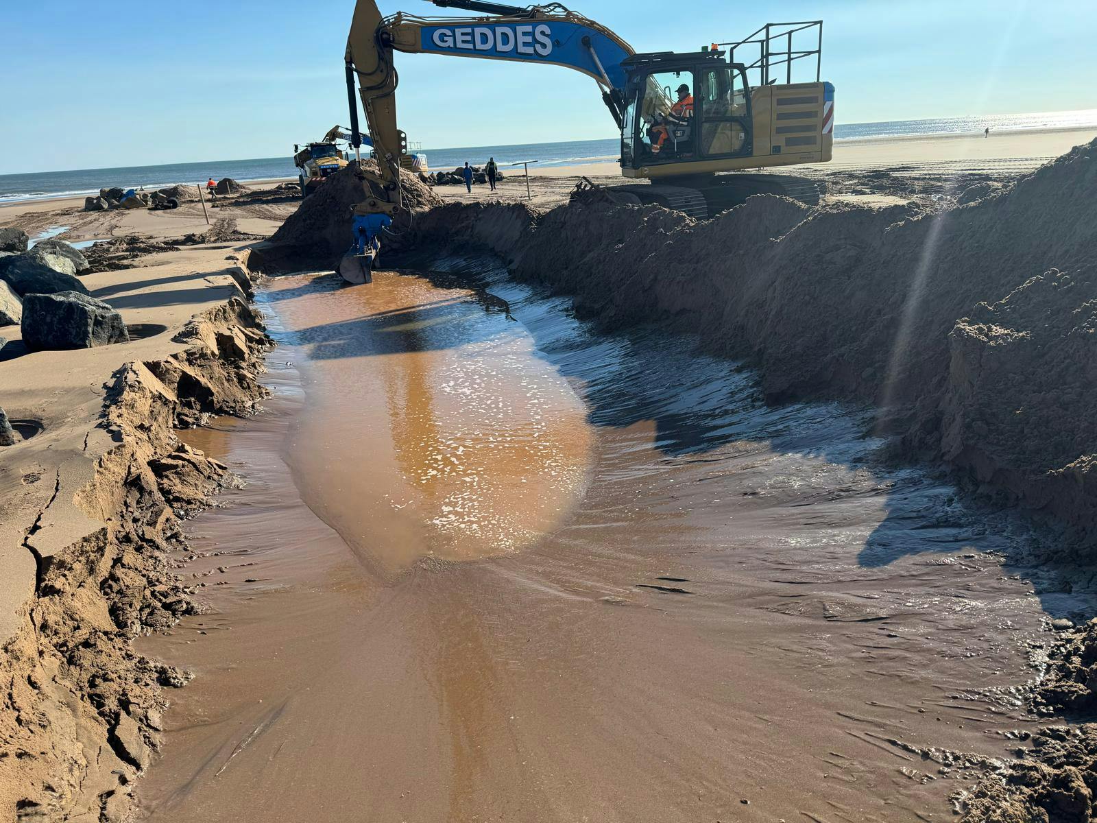
 Challenging ground conditions were initially reported on 10 October, with running sand at a depth of 50cm below ground level. Difficulties were experienced when the foundation layer, comprising of a geotextile and reno mattress, were placed on the running sand layer, materials were sinking, even in low tide conditions.
 Installation of specially engineered large sandbags to infill the lowest sections of the dunes.
 Construction of short-term proposals - initially one rock groyne and associated works.
 .
. 


