NCN1 Improvements
The National Cycle Network Route 1 (NCN1) runs for 30 miles through Angus connecting the coastal communities of Monifieth, Barry, Carnoustie, Easthaven, Arbroath, Lunan and Montrose. Almost half of this is on traffic free sections with close to 20 miles of route running from Dundee to Arbroath making it both regionally and locally important. Sustrans Places For Everyone funding allowed of the completion of the Broughty Ferry to Monifieth scheme with the Arbroath project.
Sustrans have a 20-year plan to make the NCN safer and more accessible for everyone. There is a focus on doubling the traffic free sections from 5,000 to 10,000 miles and taking people off fast or busy roads.
NCN1 - Elliot Links
Reports of flooding on the coastal path at Elliot Links were reported by elected members to officers from January 2021 and over subsequent months. These reports were investigated by officers at the time with further reports of funding coming from members of the public via Sustrans. The flooding over the winter period made the path impassable at worst and proved a major inconvenience to those using the route. The path would routinely dry out by summertime and allow people to pass through this section safely. However, without interventions it was considered that the path would again become impassable during the winter months of 2021/22.
The path level was lifted with additional drainage installed underneath that prevents further flooding of the route. As well as providing huge attenuation properties of any future flooding, it is hoped that the large bore drainage pipes that were installed just under the new path surface, spaced at 5 metre intervals along the route, will provide shelter and habitat for wildlife. The existing wildflower population that numbered several species, that bounded the previous path level on both sides, has gradually encroached onto the new earthworks further ensuring biodiversity is maintained along the edges of the new path. A new, recycled, bridge was installed over the Dowrie Burn at a greater height than the previous bridge that was constantly overrun by flood waters. Clearing out of the Dowrie and Penstone Burns was also carried out to further prevent future flooding.
Phase 2 of the works delivered in 2024 continues from where the previous path works terminated and has improved the surfacing for 200m through to the Balcathie level crossing. The completion of this section is the next step to providing a sealed surface (upgraded from current whin dust) from Arbroath to Easthaven. A previous study that looked at the whole route made several recommendations in improving the quality and accessibility and these will be planned as and when funding allows. The next phase (which will be delivered in 2026) will continue the surface improvements and a brand new accessible bridge over the Elliot Water.
Phase 3 of the improvements to the NCN at Elliot were delivered in 2026 and widened the previous path while upgrading the surface heading east from the Balcathie level crossing. The works here also included a spur from the east side of the Elliot Water heading to the pedestrian bridge that crosses the railway line and links into the A92 path along Dundee Road. The next phase is to connect these improvements to a new ramps leading to an accessible bridge that will replace the current narrow structure.
NCN1 - Barry Station
The works at the Barry Station section of NCN1 were completed in Autumn 2023. The improvements at Barry Station started at Station Road and saw the realignment of NCN1 through the storage area which previously had made this section more challenging due to the surface condition and vehicular movements in this area. The addition of a new culvert and street lighting has improved both the flood risk and safety making this section passable all year round.
NCN1 - Carnoustie
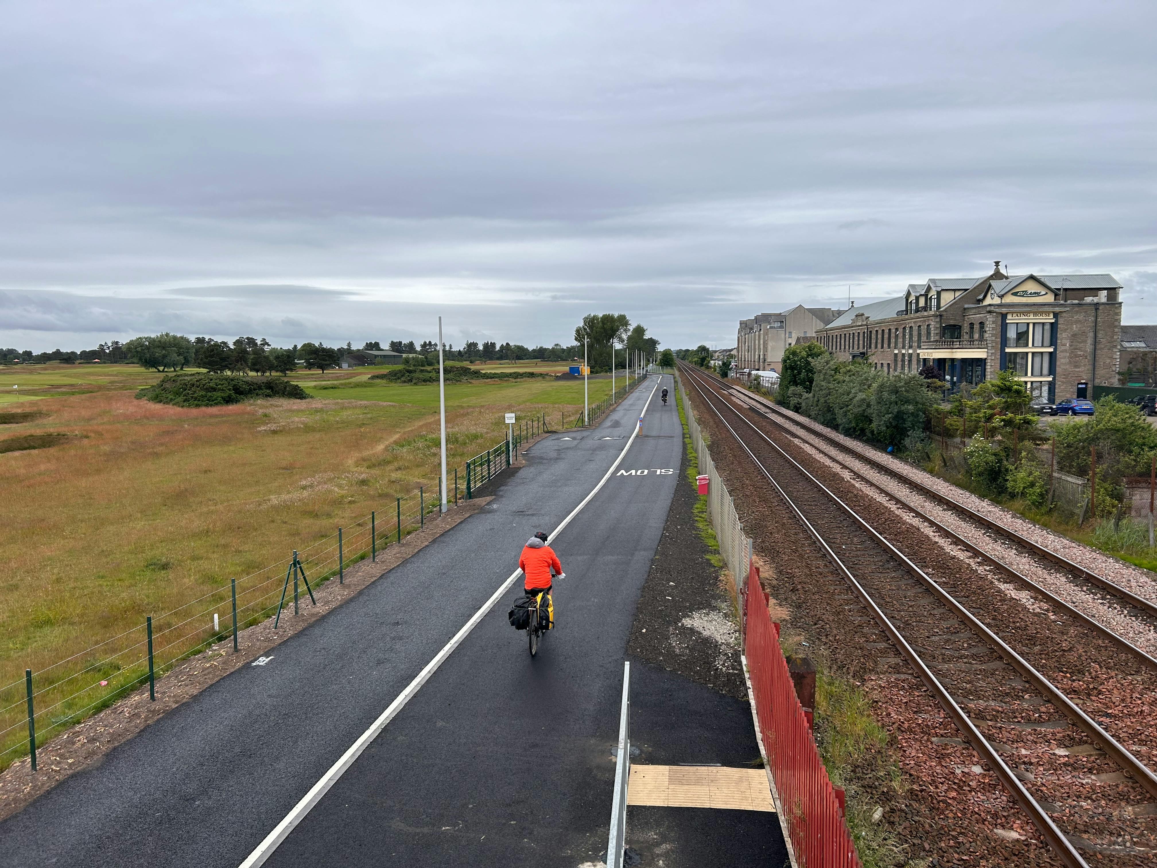
As part of a series of improvements on NCN1, Angus Council were tasked with improving a section of NCN1 core path, running in a 1.3km long narrow corridor bounded tightly one side by one of the Carnoustie Golf Courses and the East Course Railway Line on the other. This section had an extremely poor surface and was shared by Non-Motorised Users (NMU) and vehicles with no separation between the two. Angus Council had received many reports of safety issues from users that included trips and falls caused by the poor surface and conflict between those using the route.
As part of the NCN1 Carnoustie Active Travel Improvements, Angus Council approached Clearview Intelligence to design a Pedestrian and Cyclist Priority Scheme for a critical pinch point over the Barry Burn where vehicles and non-Motorised Users (NMU) must share the same road space. The system's internal programmable logic ensures that it operates correctly by responding appropriately when a pedestrian or cyclist is detected.
Pedestrian and Cyclist Detection: When a pedestrian or cyclist approaches from either direction, they are detected by the Clearview Connex Active LIDAR system. The signals for pedestrians and cyclists change from red to green, allowing them to safely travel through the pinch point without stopping. The system also allows for the recording of the number of people using the path here.
NCN1 - Monifieth
Picking up where the Dundee Broughty Ferry to Monifieth project terminates, this section of NCN1 takes cyclists off Marine Drive and onto a brand-new path running parallel to the road. This slight realignment will not only prevents any possible conflict with other road users but also allows for the safer passing due to the inclusion of street lighting. The new path continues up the west side of Marine Drive (having crossed it near to Riverview Caravan Park entrance) before joining the existing path that leads to the football club pitches. Another new section branches off from this and runs parallel with the road before a crossing point and segregated section of the route at the car park. Path users will then be able to pick up the existing section that leads from here to Barry Station at an improved crossing point. This project replaces 800metres of currently on-road cycling provision with shared use walking and cycling provision.
NCN1 - Montrose
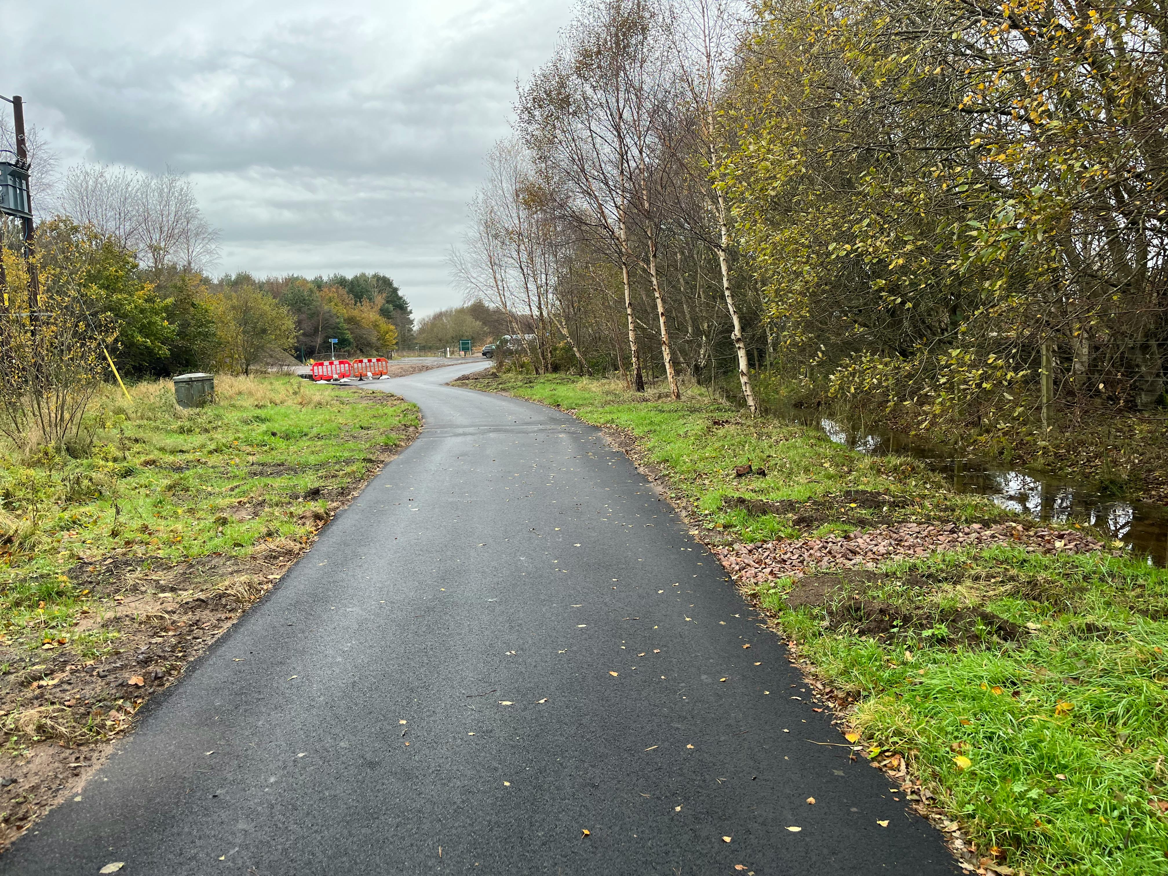
Poor path surfacing, barriers and flooding of large sections of the path near Faulds Road and Rosehill Road made accessibility difficult on this vital offroad path that runs from the north of the town and connects to the secondary school, medical practice and leisure centre. Improvements here were carried out in early 2026 and included the removal of barrier, path resurfacing and additional drainage installed. Future phases will look at lighting and further accessibility improvements.