North Angus, Brechin and Montrose Tourism and Heritage Improvements
Consultation has concluded

The survey is now closed. We'll use your feedback to help us create a shortlist of projects. The projects which have the most backing and will deliver the biggest economic and social benefits for the area, as well as protecting the built and natural environment, will go forward in our bid for funding.
Thinking Big For North Angus
We were in the early stages of designing an exciting and ambitious scheme for North Angus, Brechin and Montrose when Storm Babet hit the area with such force.
While this has clearly changed priorities for this area of North Angus, we believe that this scheme could compliment recovery work by enhancing new and existing tourist and heritage destinations, connecting them via safe routes to walk, wheel and cycle.
We are doing this because we believe that North Angus has a lot to offer, especially if properly connected. We are looking at several sources of funding separate from and in addition to recovery funding which we could access to support the right scheme, backed by the community and supported by local businesses.
Therefore we are keen to progress this consultation and still need you to help us to refine the design. In the information below, we have presented the overall scheme, broken down into six zones. We want to hear your views, good and bad, on the overall plan. We would also love to hear if you have any further ideas to add, could point out anything we may have missed, and comment on any specific aspects of the outline design.
We believe that this ambitious undertaking could enhance the area for the people of Angus and beyond, creating prosperity for the area now and in the future. But we can't do it without the funding, and for that we need your help.
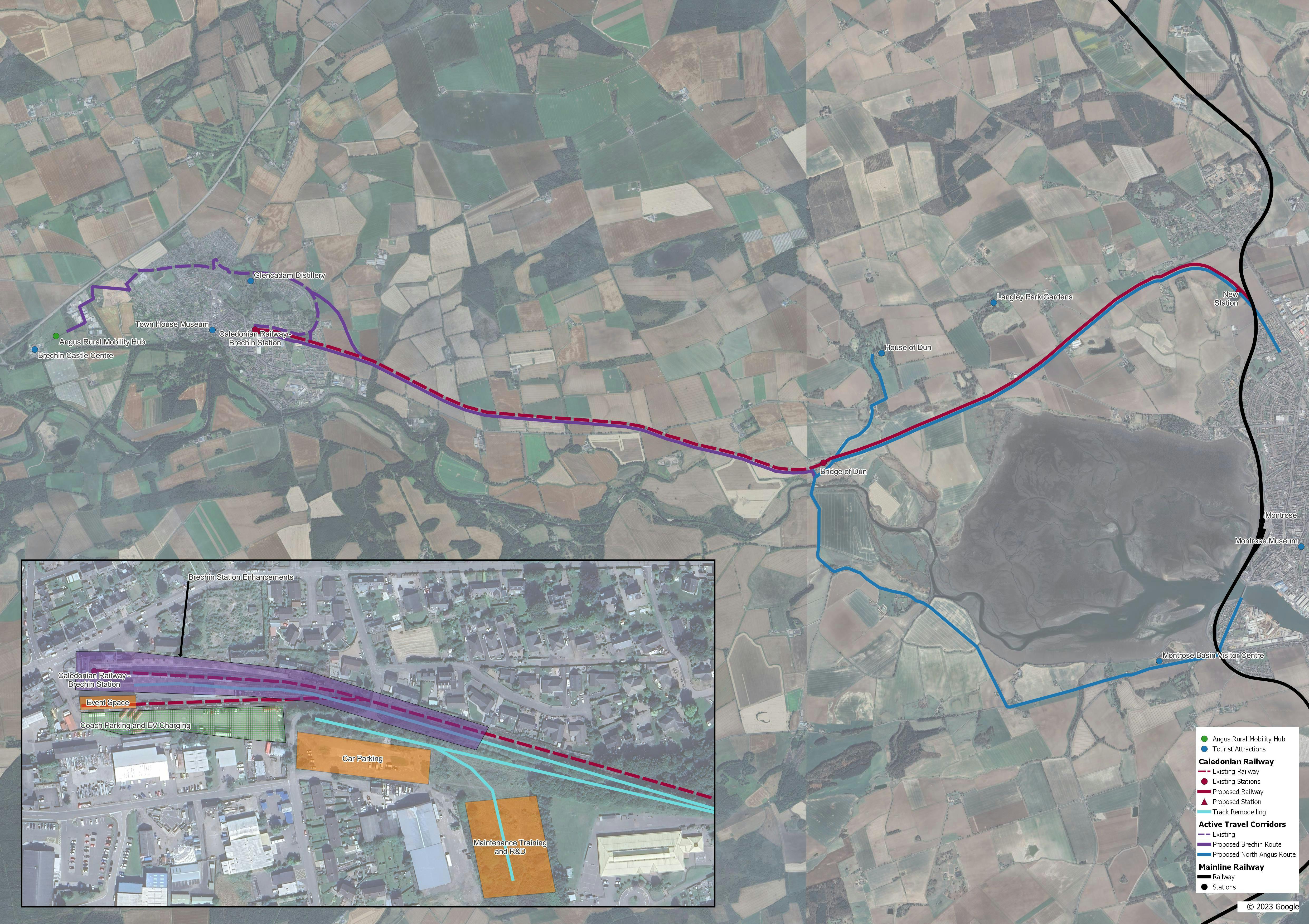
The Six Zones
Take a look at the six zones detailed below, each of which consists of a list of projects we'd like to include for that zone. Some of these are essential for the scheme to work, some are nice to have, and some are aspirational.
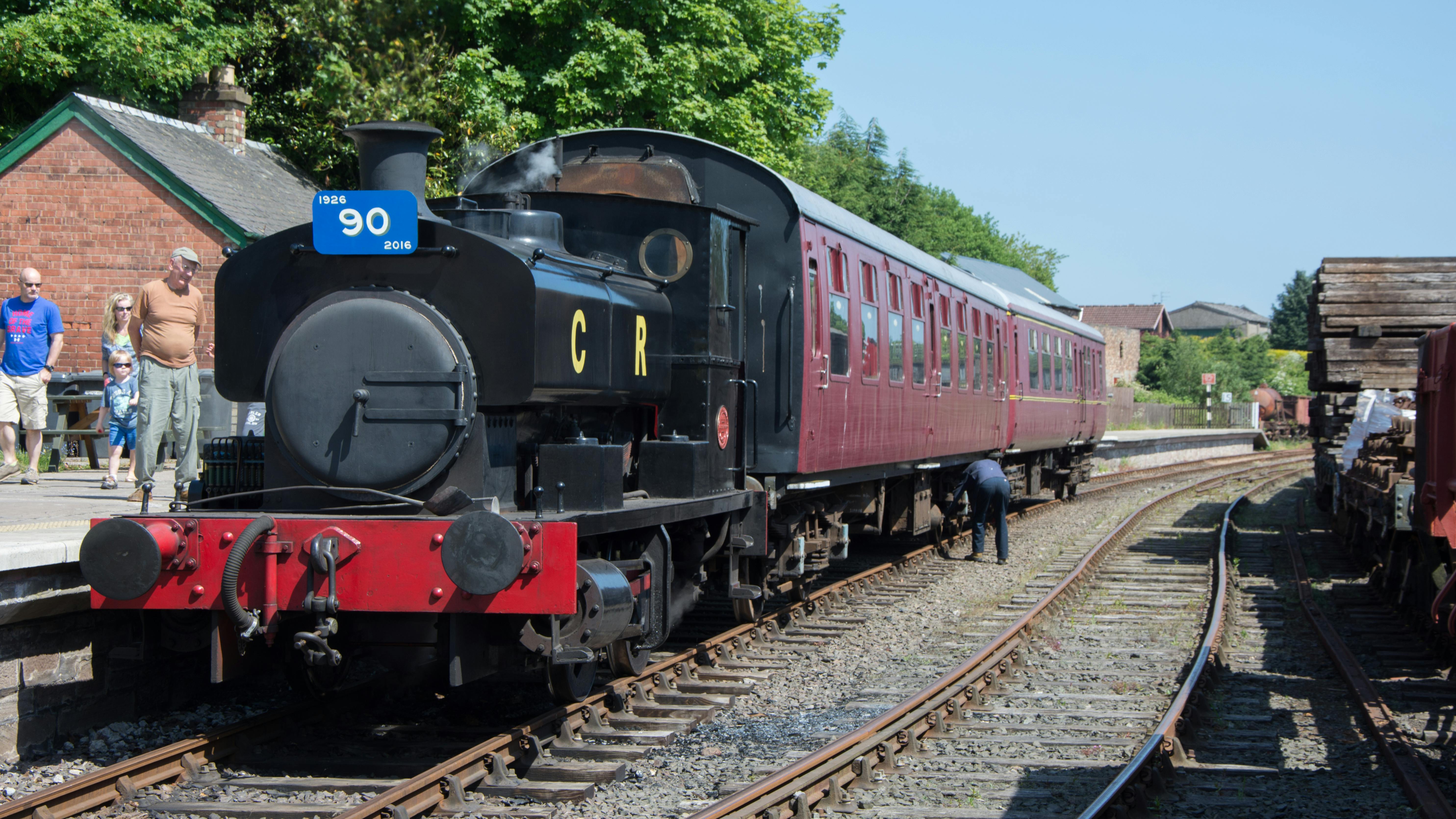
Zone 1 Brechin Station Development
- New platform 3 and track remodelling
- Heritage lighting
- Accessible signal box and water tower
- Acquisition of Haulage Yard site to develop:
- Coach parking
- EV charging
- Maintenance/R&D/green energy training facilities
- Station turntable
- Conversion of coal shed into event space
- Acquisition of Goods Yard site to develop:
- Car parking
- Terminus of Brechin to Montrose walk, wheel and cycle route
- Cycle facilities
- New station footbridge (being taken forward by Caledonian Railway)
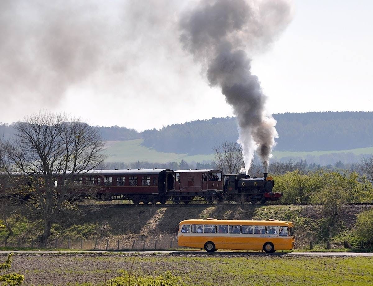
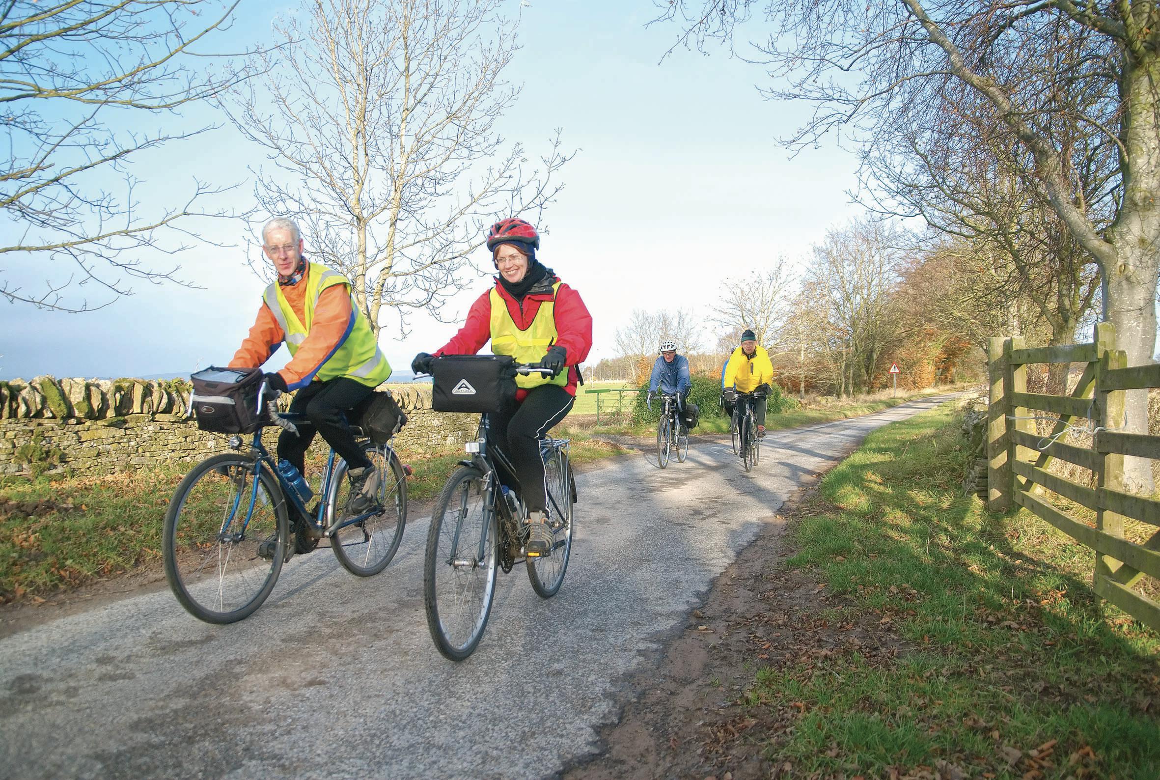
Zone 2 Brechin to Montrose Walk Wheel and Cycle Route
- Off-road walk wheel and cycle corridor alongside railway between Drumachlie Loan, Brechin and new Montrose Caledonian Railway station
- Upgrade of existing informal path through woodland and across Den of Leuchland culvert
- Pedestrian/cycle bridge over Drumachlie Loan
- Connection to new Montrose Caledonian Railway station and existing path network in Montrose
- Crossing of A935 near Kirkhill via uncontrolled crossing (cycle route only) or underbridge (rail and cycle route)
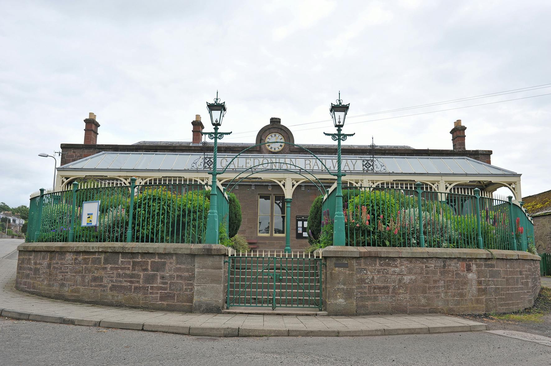
Zone 3 Caledonian Railway – Reinstatement of Railway Line between Bridge of Dun to Montrose
- Reinstatement of railway between House of Dun and new Montrose station (for the Caledonian Railway only)
- New Montrose station (for the Caledonian Railway only) north of town centre
Zone 4 Bridge of Dun Station Developments
- Improvements to station facilities and accessibility, making it a destination and stop-off for the Caledonian Railway
- Buying the land adjacent to station to develop transport museum and workshop (linking with Angus Transport Group)
Zone 5 Expanding Walk, Wheel and Cycle Routes and Supporting Infrastructure Around Brechin
- Improved pedestrian/cycle path between Andover Primary School and Drumachlie Loan
- Abolition of Andover Primary School level crossing and replacement with accessible pedestrian/cycle bridge
- Links between new walk wheel and cycle corridor and Nature Trail
- Replacement of Bog Road bridge – vehicular or pedestrian/cycle only
- New e-bike hire and facilities, location(s) TBC
- New walk wheel and cycle corridor between the Angus Rural Mobility Hub and Nature Trail
- Improved connectivity between key tourism destinations e.g., the River Walk, Glencadam Distillery, Brechin Cathedral, Brechin Townhouse Museum
Zone 6 Expanding and Connecting Safer Walk, Wheel and Cycle Routes around Bridge of Dun and Montrose
- Improved walk, wheel and cycle route between Bridge of Dun station and House of Dun
- Improved walk, wheel and cycle routes between Bridge of Dun station and Montrose basin, linking to south of Montrose & town centre
- Connection between new Brechin-Montrose walk, wheel and cycle route and the National Cycle Network (1) in Montrose
- Connection to/upgrade of Hillside path on Montrose path network (Dubton to Newhame Road via Borrowfield Park)
Now go to the survey below and have your say! We have attached maps to help you understand where these projects are and how they fit together to make a bigger scheme from Brechin to Montrose.
How to have your say:
Survey
When considering the zones, please think about these questions and then complete the survey below before 22 December 2023 (The closing date has been extended to allow people extra opportunity to have their say)
- Are you supportive of this ambitious scheme as a whole?
- Rank the six zone in order of preference and priority
- What do you think the benefits to North Angus, Brechin and/or Montrose would be if this scheme was successfully funded?
- Do you think that there would be any negative impacts on North Angus, Brechin or Montrose if this scheme was successfully funded?
- Do you have any comments on any of the projects listed in any of the zones?
- Is there anything else we should consider or have missed within this scheme?
The survey has been updated, however all answers provided to date will be used as part of the evaluation process. If you wish to complete the survey again, please do so.
Interactive Map
Our interactive map has pins dropped in it to represent each of the six zones, which lists the projects within that zone. You can add pins of your own to comment on the whole or any part of that zone. If there is anything you think we have missed, please add a pin, along with your comments, to the map so we know exactly the location you are talking about.
Have your say in person
You’ll also be able to provide feedback at Brechin Library, where information boards will be on display.
You can find more details of opening time on the Brechin Library web page
What happens next
We'll use your feedback to help us create a shortlist of projects. The projects which have the most backing and will deliver the biggest economic and social benefits for the area, as well as protecting the built and natural environment, will go forward in our bid for funding.